Welcome to My Motorcycle Adventure Blog

If you are new to the blog, please know that the most recent blog entry appears immediately following this itinerary introduction. In order to start from the beginning of the blog entries, you should scroll to the bottom of the screen and read from up from there. Also, please see the photo albums on the right side of the screen. The album titles match the titles of the blog posts.

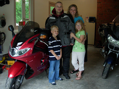
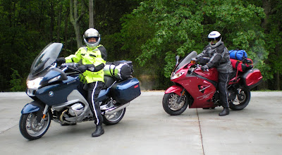
From May 11-June 7, 2008, my father and I will be traveling across America by motorcycle. I have started this blog so family and friends can follow along. I've posted our itinerary because my wife and children want to know where I'm sleeping every night. Maybe some others of you want to know as well. If we're coming to a town near you, make sure to let us know.


May 11: High Point, NC to Spring Creek, NC
May 12: Spring Creek, NC to Nashville, TN
May 13: Nashville, TN to Searcy, AR
May 14: Searcy, AR to Shawnee, OK
May 15: Shawnee, OK to Tucumcari, NM
May 16: Tucumcari, NM (Rest Day)
May 17: Tucumcari, NM to Gallup, NM
May 18: Gallup, NM to Williams, AZ
May 19: Williams, AZ to Page, AZ
May 20: Page, AZ to Henderson, NV
May 21: Henderson, NV to Los Angeles, CA
May 22: Los Angeles, CA (Rest Day)
May 23: Los Angeles, CA to Orcutt, CA
May 24: Orcutt, CA to Salinas, CA
May 25: Salinas, CA to Mariposa, CA
May 26: Mariposa, CA to Winnemucca, NV
May 27: Winnemucca, NV to Salt Lake City, UT
May 28: Salt Lake City, UT (Rest Day)
May 29: Salt Lake City, UT to Jackson, WY
May 30: Jackson, WY to West Yellowstone, MT
May 31: West Yellowstone, MT to Cody, WY
June 1: Cody, WY to Rawlins, WY
June 2: Rawlins, WY to Grand Lake, CO
June 3: Grand Lake, CO to Colby, KS
June 4: Colby, KS to Blue Spring, MO
June 5:
Blue Springs, MO to Mount Vernon, IL
June 6: Mount Vernon, IL to Grayson, KY
June 7: Grayson, KY to High Point, NC

Saturday, June 7, 2008

Homecoming!

We made it!

After over 7,000 miles and tons of adventures, our trip is complete. Our families welcomed us home to High Point this afternoon.

I'll post more soon, including our final thoughts about the trip, but I just wanted to let everyone know that we are home safe and sound.

We appreciate all the interest and support from so many of you during the last month. This blog thing helped us stay in touch with everyone, and it helped us share our experiences.

315.6 miles today. 7,237.4 total miles.

Friday, June 6, 2008

Eastern Standard Time (and Other Observations)

We're back in Eastern Standard Time.

We crossed over just before we stopped for lunch in Kentucky. We also noticed that we are squarely back in the South. The Wendy's/Truck Stop brought echoes of the country or southern voices that are so familiar to us. It began to feel like home. The photo above celebrates our crossing into Indiana (obviously), but I missed the Kentucky sign (once again, a large river, the Ohio, prevented this picture).

We encountered the biggest traffic jam of the trip today near Lexington, KY. There is some construction on I-64, and we sat in traffic for over an hour after being on the bikes for over an hour (which makes over two straight hours on the bikes, a record we didn't want to set today). After the traffic jam, Dad rested in the shade.


That's about it for today, although after almost 7,000 miles, we have some observations we'd like to add about motorcycle riding and the United States of America.
  • Most people are nice to motorcyclists, although some drivers don't pay close enough attention to their surroundings. Missouri promoted motorcycle awareness in a comforting way.
  • Most people enjoyed hearing about our adventure.
  • Miles go by differently on a motorcycle. You never once lose contact with the road. You never suddenly ask yourself where the last 20 miles went.
  • I'm glad the United States had the foresight to create so many National Parks.
  • Simply put, our country is vast.
  • Simply put again, our country is beautiful.
  • The more you see of our country, the more you want to see.
  • There is far more to see than one could ever see.
  • It's shocking how many states do not have helmet laws.
  • If it seems like more tractor trailers are on the road, that's true. Federal statistics indicate that there are 30% more trucks on the road than in the 1990s.
  • Gas is expensive.
  • It seems like Subway may be catching up with McDonald's in numbers of franchises.
  • There an awful lot of deer in America.
Tomorrow, look for photos from our homecoming!

354.3 miles today. 6,921.8 total miles.

Thursday, June 5, 2008

St. Louis and Beyond

We appear to be one day ahead of the bad weather that is plaguing the Midwest. Our decision to arrive home a day earlier seems to be a wise decision. Several tornadoes touched down in the vicinity of where we were yesterday. Instead of dealing with that, we just had to suffer through 90s temperatures and gusty winds.

The highlight of the day was stopping in downtown St. Louis to see the Arch. Coming into St. Louis on I-70 East, we planned to take that right to the Arch before turning onto I-64 East to Mount Vernon, Illinois. However, in the outskirts of St. Louis, we began to see detour signs indicating that I-64 East was closed. The alternate route would not take us by the Arch. We thought we had no choice but to take the detour. Well, ultimately, we discovered that the detour was not necessary, as I-64 was closed in a portion that would not affect us. So, we turned around and took our previously planned route to downtown. However, we had one last miscue (my fault) when we got off at the Arch exit and then missed the turn for the Riverfront Street and went all the way across the Mississippi River into Illinois on the MLK Bridge. We finally got turned around and found a good spot from which to view the Arch, which was impressive.

The Arch is the tallest national monument in the United States at 630 feet. Construction began February 12, 1963, and the last section of the Arch was put into place on October 28, 1965. The Arch is a structure known as a catenary curve, which is the shape a free-hanging chain takes when held at both ends, and is considered the most structurally-sound arch shape. The space between the Arch’s legs on the ground is 630 feet, the same as its height. One day, I hope to be able to go the top of the Arch and look out the observation window.

The other minor occurrence today was an encounter with a snake. At a rest stop in Missouri, just as we were getting back on the bikes, a long black snake sauntered across the parking lot toward us. Of course, I had to take a couple pictures for my wife, who just loves snakes. She would have been greatly disappointed to have missed the snake.

Today, I included a couple pictures that illustrate bike issues. First, you’ll see a photo of the bugs that stick to the headlights (same as the helmet, although I didn’t take that photo). You’ll also see a shot of the wheel lock that serves as security (which is combined with a cable lock that connects both bikes together).

I did not get a photo of the Illinois sign today, as I encountered the same issue as when we crossed into Arkansas. The state line for Illinois/Missouri is in the middle of the Mississippi River. No chance to get that shot.

We are beginning to get very excited about the trip’s conclusion. Our loved ones are anxious as well. In two days, we’ll be in back in High Point.

324.1 miles today. 6,567.5 total miles.

Wednesday, June 4, 2008

Yellow Man

Instead of following the Yellow Brick Road across Kansas today, I followed the Yellow Man.

For those who have been looking at the daily photo albums, I’m sure it has been hard to miss Dad’s motorcycle jacket – it’s fluorescent yellow (high visibility, as the manufacturer calls it). You see, Dad’s motorcycle has cruise control while Little Red (the Triumph) does not. So, on the interstate highways, Dad always takes the lead and sets the cruise. I follow along behind. You can imagine how hard it is not to look continuously at the back of that jacket. After thousands of miles, this jacket has been burned into my gaze. Even when I close my eyes (I don’t do this while driving), I can see the Yellow Man.

Unfortunately, the state of Kansas did not have much to distract my attention from the Yellow Man today. I don’t want to offend anyone from Kansas, but there was just not much to see from I-70. I’m sure if we’d gotten off the beaten path a bit we’d have had more luck. Despite the lack of natural attractions or landmarks, it is quite apparent that a lot of famous people come from Kansas. We passed, in succession, a town named for Annie Oakley (Oakley, KS), the boyhood hometown for both Bob Dole and Arlen Specter (Russell, KS), the Dwight D. Eisenhower Presidential Library and Museum (Abilene, KS), and The OZ Museum (Wamego, KS). We also passed an advertisement for the World’s Largest Prairie Dog. Unfortunately, we did not stop to see any of these attractions. I will apologize in advance for those folks out there hooked on the photos and not the text. We rode so hard, I did not take a single photo of the Kansas landscape. There is no album today. I'm also not sure how many photos I'll be taking the next couple of days, either. We are in bee-line mode for home.

The highlight of the day was found at a Rest Area near Topeka. While we had a snack and a drink of water beside the motorcycles, I took a stroll in the shade. Something fluttered away from me as soon as I got in the grass. A baby bird had fallen from the tree under which I sought shade. The bird was too big for a nest, yet too small to fly. So he merely sat there in the grass, his parents worrying over him in the tree above. After a couple photos, we were again on our way. Here is our little friend. I have no idea what kind of bird he is. Maybe some of you can help me identify him?
We did not have hotel reservations when we left this morning. Our goal was to reach Lawrence, Kansas, but we managed to get well beyond it. We finally stopped riding about 3:45 p.m. in Blue Springs, Missouri, which is a suburb of Kansas City about 10 miles from the Missouri state line. We treated ourselves to Hampton Inn.

I have managed to miss the last two state signs (Kansas and Missouri). It was way to stormy to stop as we crossed into Kansas (small hail), and I-70 was way to crowded today as we crossed into Missouri (five lanes of traffic, we were in the middle one). So now I’ve missed only three.
The weather was hot and windy today. Mostly sunny. I think we’ve been smart to head home a day earlier. Despite the storm yesterday, it appears that we will be a day ahead of the next round of bad weather that is heading east. Let’s hope it stays that way.

Tomorrow we have reservations in Mount Vernon, Illinois.

392.7 miles today. 6,243.4 total miles.

Rocky Moutain High

Today was both glorious and ghastly.

First, the glorious...
Then, the ghastly...


We left Grand Lake, Colorado, at 7:00 a.m. under clear skies and a 40-degree temperature. At four miles, we entered Rocky Mountain National Park, where we immediately saw some moose and elk (sorry, no pictures).

Highway 34, also known as Trail Ridge Road, cuts through Rocky Mountain National Park. All of the photos from the park were taken from this main road. Approximately 48 miles long, Trail Ridge Road is the highest continuous paved road in the United States. Its highest point is 12, 183 feet above sea level. For comparison purposes for you North Carolinians, Mount Mitchell, the highest point in the Appalachian Mountains and the highest peak in the eastern United States, is a mere 6,684 feet above sea level. One thing that we noticed as we slipped across the top of the mountains - there were absolutely no guard rails. At one point in the Tundra (where no trees or bushes grow because of the altitude), the road had nothing to buffer your fall.

You may have noticed yesterday that some of the pine trees looked dead in the photos. That’s because they were. The western United States is having a horrible problem with bark beetles. Millions of trees have already been killed, and, largely, nothing can be done to save them. Rocky Mountain National Park is doing what it can by spraying in high-tourist areas, but the evidence of the 17 species of beetles’ carnage is overwhelming and sad.

Overall, we absolutely loved crossing the Rocky Mountains. While we didn't know what to expect because of the overabundance of dead pine trees, the sheer size of the mountains more than made up for that blight.

After emerging from RMNP, we were able to stop by BMW of Northern Colorado and pick up the part for Dad’s saddlebag. Now, if we’d only had the time to install it…

The weather turned sour around Bennett, Colorado (around mile 140 out of 370). For the remainder of the day, we battled thunderstorms. Unfortunately, both we and the storm were heading east along I-70. We kept running into the back end of the storm, which caused us to stop because of lightning. We stopped a total of four times. Each time, we’d wait a while for the storm to get ahead of us, then we’d get back on the road until we ran into it again. Quite an annoying pattern. I hope you’ll take a look at one of my favorite photos in the album. In Bennett, I managed to capture a bolt of lightning as it struck the ground. It’s quite a picture, if I say so myself.

We finally made it to Colby, Kansas, around 8:45 p.m. It was definitely a long day, plus we crossed back into the Central Time Zone, which means that we will lose an hour of sleep tonight (but we are now only one hour behind!).

Tomorrow’s forecast is partly cloudy and windy. We are not supposed to see any storms like the one we followed today (although you never know).

370.7 miles today. 5,850.7 total miles.

Monday, June 2, 2008

South to Grand Lake

Today was a gorgeous day to ride. Sunny the whole way, and the temperature rose quickly this morning and then held in the mid-70s. Plus, the scenery was as gorgeous as the weather.

We had lunch today at the Moose Cafe and dinner at the Bear's Den. We certainly got our fill of animal-themed eateries.

We arrived in Grand Lake early this afternoon. Early enough to contemplate the remainder of our trip. We have a rest day scheduled for tomorrow, but we're feeling pretty fresh as it is. So, we have decided to ride on past Estes Park tomorrow into Kansas. This will do two things for us. First, it will get us home a day earlier than we planned (Saturday instead of Sunday), and it will allow us for a rest day if we need it or if we run into bad weather. We've checked the weather, and it looks like we can sneak home without too many issues.

Our families will be happy to have us home a day sooner.

So, check the updated itinerary for our new stops.

179.0 miles today. 5,480.0 total miles.

Sunday, June 1, 2008

Wyoming North to South

Today we ran Wyoming north to south without setting tire on the interstate. It was a good ride (and weather) although occasionally boring. All of the state highways had a speed limit of 65, which we did not really break because of the abundance of deer (no photos of them).

Highlights of the day were the Wind River Valley and State Park and the Boysen State Park. The terrain in Wyoming is remarkable, all in all. The landscape can change within minutes, from rocky cliffs to wide ranging vistas.

Our hotel in Rawlings, Wyoming, is an Oak Tree Inn. I've never stayed at one before, but this is one weird hotel. The rooms are fine (actually good), but there are no service people physically in the building. There is no front door, either (check the photo album). To register, you have to go to Penny's Diner next door (open 24 hours), where they have a little window that serves as the Front Desk. If you should need a bar of soap, one of the waitresses will wipe off her hands and run one over. This is not a lie.

Tomorrow we cross over into Colorado. Only seven days to go. Our families are looking forward to our return. I did get to "see" my wife and children tonight via Skype video call. They look great, even though they got a bit too much sun yesterday at the new YMCA's pool. Crispy critters, I think.

264.4 miles today. 5,301.0 total miles.

Yellowstone the Great

Just a short note this morning. Our second day in Yellowstone was incredible. I took so many picture, I wore out the battery (don't worry, I had a spare).

We got to the hotel in Cody, Wyoming (the Rodeo Capital of the World) around 7:00 p.m. I was simply too tired to process/post so many pictures and write a detailed blog to go with them.

So, I'll update this later tonight. For now, you'll have to enjoy the photos without captions in the album.

Despite our love of the Grand Canyon, Yellowstone National Park has moved to the top of our list. Nothing can match the singular power of the Grand Canyon, but Yellowstone has such variety and sheer multitude of things to see.

We entered Yellowstone at the West Entrance near Cody. Almost immediately we began to see more buffalo along the Madison River. I got some good shots of several baby buffalo, which were a treat to see. Just after taking the pictures of the babies, we sort of had a "run-in" with a stray adult buffalo. I'd heard stories of the wildlife simply blocking the road, and that's what this one did. He halfway charged a white car about 5 feet in front of me as we pulled away from the baby buffalo. The white car sped off, leaving me at the front of the line. The buffalo trotted right down the middle of my lane for about 25 feet, and then he turned completely to face me and blocked the road. I stopped. He stopped. He lowered his head, as if he were going to charge. We looked like two gunfighters facing off. I wanted no part of him, so I pulled over to the side and let other cars pass to achieve a buffer zone. Once the cars started coming a little closer, he finally decided to head back out to the riverside pasture with the rest of his herd.

Once we reached Madison Junction, we turned north and went to Norris Junction, which contains a geyser basin. Here, we had an unintended hike. In order to see the geysers, you have to walk. We started along the shorter route to see some smaller geysers (which we did), but then we ran into a Ranger who mentioned that if we kept going we'd get to see the world's tallest geyser, Steamboat Geyser. Well, we got ourselves on a one-way track for almost 1.5 miles. We did get to see Steamboat Geyser, though. But, what the Ranger neglected to tell us was that while, yes, Steamboat Geyser is the world's tallest geyser, it only erupts every 5-40 years. Not good odds. Its last eruption was on May 23, 2005. So we continued on to the bikes, a bit disappointed.

After Norris Geyser Basin, we kept going north to Mammoth Hot Springs. This was an unusual place, probably my favorite place of the day. It has an upper and lower terraces (or levels) of hydrothermal ground (just like the geysers). Limestone is the underlying rock here instead of rhyolite, which is dominant in the park's other major hydrothermal areas. The heated water rises through the rock, it dissolves the compound in the limestone, and, at the surface this is deposited as travertine, the rock that forms Mammoth Springs. Colors abound.

Beyond Mammoth, we turned east to the Tower-Roosevelt Junction (where the Tower Falls is). Between Mammoth and Tower Falls we encountered more wildlife, including more mule deer (they seem to be the "cows" of Yellowstone - they're everywhere), and a herd of pronghorns (see album).

The Tower Falls was impressive, which is in Hanging Valley. Among all the falls we saw, it clearly attracted the most attention (judging by the cars and people). Apparently, folks really like waterfalls.

After Tower Falls, we took a newly-opened, high-elevation road south to Canyon Village. I took a number of snowscapes during this stretch of road. Once in the Canyon area, we once again saw a waterfall, the Upper Falls, which was not as impressive (my opinion, others vary) as Tower.

From the Canyon area, we went southwest over the Fishing Bridge and then 54 miles to Cody. This piece of highway, although not in the National Park, was as impressive as they come. A huge descent through rocks and cliffs gives way to valley riding with lots of long and easy twists that you can take at higher speed (the limit is 65). We stayed around 60, though, as many deer and bighorn sheep live through here. One of the best moments of the day came when we stopped along a deserted piece of highway and watched a herd of bighorns simply graze and drift along the valley grasslands. I tried to get a few photos, but they aren't among my best.

All in all, our second day in Yellowstone was our best day of the trip. We were sad to leave.

183.3 miles. 5,036.6miles total

Saturday, May 31, 2008

Grand Teton & Yellowstone One

We had a great ride through the Grand Teton National Park and a spectacular first day in Yellowstone. The weather was good until our last few miles into West Yellowstone, when it rained on us. But even that didn’t dampen our spirits.

The main difference we noticed immediately between the Grand Teton National Park and Yellowstone is the variety of landscape and features. I won’t take anything away from the Tetons beauty, but as you work through the park, they are just about the only feature to look at (after all, the park is named after them). Yellowstone, however, seems to have an abundance of variety.

Our trip into Yellowstone at this time of year was destined to bring us a mixed bag of weather and a wide range of conditions inside the park. When we entered from the south, there was only a bit of snow and lots of green. After only 10 miles, however, the temperature dropped and the snow cover increased. Snow banks, some over 10 feet high, still lined the roadway (I wish I had taken a photo of a snow bank that towered over an RV). A lake was still frozen. Then, after a drop in altitude, things changed to a more spring-like terrain.

Of course, Yellowstone is known for Old Faithful, which the queen of geysers and the world’s best known geyser. Yellowstone National Park is home to the majority of the world’s geysers and hot springs. My children have never heard of geysers, so allow me a moment to explain how they work. Geysers are hot springs with narrow spaces in their plumbing, usually near the surface of the earth. These constrictions prevent water from circulating freely to the surface where heat can escape. The deepest circulating water can exceed the surface boiling point. The pressure increases with depth. As the water rises, steam forms. The steam expands as it reaches the surface until it is too large to pass through the narrow spaces. At a critical point, the confined steam and bubbles cause the geyser to overflow in a violent way. Tremendous amounts of steam force the water out of the small vents in an eruption. We did not have quite enough time today to explore all the geysers Yellowstone has to offer. That would take days.

We did see some wildlife today, too. Mainly, we saw bison/buffalo and mule deer. Once or twice, as we were riding along, buffalo grazed on the side of the road. This was very interesting to see, as motorists had to slow or stop.

This year is the 20th anniversary of the Yellowstone Fires of 1988, as they are known. Some of you may remember the summer of 1988 and how much Yellowstone was in the news. These fires raged for just over three months, from June 14 until the fall rain and snow arrived in September. Over 500,000 acres of Yellowstone were affected, and over 25,000 firefighters were involved in putting out the fires. You can clearly still see the evidence of the fires 20 years later. The lodgepole pine (the dominant tree in Yellowstone) began to regrow almost immediately, and many of the forests of baby pine stand in stark contrast to mature forests.

Tomorrow, we will continue to explore Yellowstone. We will see more geysers and wildlife, but we also plan to see some waterfalls and the Grand Canyon of Yellowtone as well.

143.4 miles today. 4,853.3total miles.

Thursday, May 29, 2008

North to Jackson

Today we headed straight north on I-15 from Salt Lake City into Idaho. We rode 100 miles before stopping (except for a few photos). The scenery was beautiful. Southern Idaho was expansive, flat, mountainous, and green, in that order. The mountains were spread out in a way that seemed different than some other states (although they probably really weren’t). The sky felt bigger, too. Also, we began to see miles and miles of sod farms that featured long emerald fields of grass and immense irrigation systems. The grass was beautiful, although the irrigation works spoiled the view.

We stayed on I-15 until Idaho Falls, where we had lunch and Dad called the BMW dealership in Loveland, Colorado, to order the part for his saddlebag to be installed next week. We then turned east toward Wyoming. The ride to Jackson was peaceful. We passed through the Snake River Canyon and past the Palisades Reservoir, both amazing land areas.

The rain held until we reached Jackson. Just after unloading the bikes, the skies unloaded as well. Tomorrow, the weather looks to be holding steady. There is a chance of rain, but it is not as much as today. We are very much looking forward to the Grand Teton National Park and our first glimpse of Yellowstone.

314.1 miles today. 4,709.9total miles.

A Day in Salt Lake City

Salt Lake City is a beautiful and gracious city. The weather was perfect all day long as well.

We ventured into downtown today by taking the ForeRunner (Salt Lake City’s light rail system) from Woods Crossing, a suburb immediately north of town. Prior to going downtown, however, we made the first of two trips to BMW Motorcycles of Salt Lake. We had high hopes of repairing Dad’s damaged left saddlebag.

Jordan, the helpful shuttle driver from our Best Western Cottontree Inn, took us over to the BMW shop just after they opened. Once there, the service people seemed stumped by our broken latch (the malfunction is the latch that locks the bag to the frame of the bike). At first, they said it could not be repaired without buying a whole new bag (very costly). Plus, they would have to order the part, and we would not be in town long enough for that. Finally, the service manager remembered that he had another similar bag in the back that was going to be returned to BMW for other reasons. He pulled the part we needed out of that bag. That made us very happy. We left BMW thinking our repair would be imminent.

Since Jordan had dropped us off at BMW, we had to beg for a ride from one of the BMW employees to the ForeRunner station a few miles away. Brandon, a young shipping and receiving clerk, offered us a ride in his classic, 1978 Buick LeSabre (see Brandon’s ride in the album). He was a nice kid (a recent high school graduate), who will be moving to South Dakota with his family in two weeks. Brandon was proud of his car, as he’d bought it from a “little old lady” for $300.

The train ride was pleasant, especially knowing that we weren’t going to have to move the bikes today. It was a true rest day. After getting off at the Central Station in Salt Lake City, it took us a few minutes to get acclimated to our map, but soon we began to walk into the main area. We first came to a hip, downtown shopping center called The Gateway. Tons of upscale shops (see if you can spot my favorite store in the photos), and the courtyard contained a nice shooting fountain in which many children were playing.

We found our way to South Temple Street and started walking east. We passed an historical building called the Devereaux House, which was Salt Lake’s earliest and most elegant mansion, dating to 1855. We also passed a television station and an artistic rock with engraved crystal spikes. Everything in the immediate downtown vicinity was in pristine condition – no dirt, trash, or any other debris. It looked like the Winter Olympics were coming up in a few weeks instead of being six years in the past (2002).

We visited Temple Square, which is the national headquarters for the Church of Jesus Christ and Latter Day Saints. It was certainly an impressive block of buildings. Dad especially wanted to see the Mormon Tabernacle, which we were able to enter and view. Also, the Salt Lake Temple towered over just about everything around, except for the massive, white office building for the church headquarters (it seemed to be about 30 floors). As a former religion major, Dad was very interested in church history. We both learned quite a bit.

We took the ForeRunner back to Woods Crossing, where our driver Jordan picked us up again. He dropped us back at BMW of Salt Lake City to pick up Dad’s saddlebag. However, the bag was not ready. After spending the day thinking it would be repaired, we found out that the latch mechanism part was specific to a left or right saddlebag. Dad’s bag was the left one; the extra part salvaged by the service manager was the right one. So, Dad’s bag is still not fixed. We have the correct part number, though, and will be placing an order tomorrow at the BMW of Loveland (Colorado). The part will be installed in one week when we pass through there.

Finally, the most exciting part of the day was a chance meeting with another motorcyclist, and adventurer named Eric Cleaveland, during our second trip to the BMW shop. If you think our trip is special, then Eric’s must be called spectacular. He is about 13,000 miles into an 18,000-mile trip that will take him from the bottom tip of South America, through Central American and Mexico, up through North America to the top of Alaska. (Check out his blog at www.MotoAmericas.com.) Eric rides a BMW R1200 GS, which is the most popular adventure motorcycle in the world. Unfortunately, Eric’s bike was leaking oil, so he had to pause his trip to get this fixed. When he inquired at the BMW shop about a hotel, they recommended the Best Western Cottontree Inn. Lucky for him, Dad and I had just called Jordan to retrieve us. So, we all rode together, and later we had dinner together (we happened to meet up at the Chinese buffet next door to the hotel). Eric is a professional photographer as well, and he expects to complete his trip in late June. It looks like I’ll have a blog of someone else’s to follow for a change!

Tomorrow we head north to Jackson, Wyoming, with part of our route in Idaho. First glance at the weather for the next couple of days looks iffy, but we’re hoping for better luck than at Yosemite.

0 miles today. 4,395.8 total miles.

Wednesday, May 28, 2008

Salt of the Earth

Our destination today was Salt Lake City, Utah.

We didn’t get started as early as we had hoped, although we were on the road by 9:00 a.m. We knew we’d be losing an hour of time once we crossed into Utah, so we had wanted to start an hour earlier if possible. Because of this, we didn’t get into Salt Lake City until rush hour, which made for a hairy arrival at the Cottontree Inn.

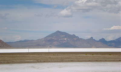
The major attraction today was the Bonneville Salt Flats and the Great Salt Lake. We passed them coming east on I-80. Once we crossed the Nevada/Utah border, the Bonneville Salt Flats began in earnest. The Salt Flats occupies an area of about 160 square miles, and the salt has been measured up to six feet deep in many places. This stretch of I-80 through the Salt Flats has to be the longest stretch of flat and straight highway in the United States (maybe even the world). I’m not joking when I say that for over 40 miles the highway did not waver one iota left, right, up, or down. No altitude gains or drops, save for the actual curvature of the Earth. This is true. It is so flat across the white salt sand that you can see the curvature of the Earth, which presents an optical illusion – the mountains in the distance seem to float in thin air. For the first ten or so miles, we were also following alongside the Bonneville Speedway, where most land speed records have been set (and many movies have filed there, too, including parts of Independence Day and Pirates of the Caribbean: At World’s End). I wish my photos did justice to this amazing natural feature.

I was not able to get a photo of the Great Salt Lake, as by that point traffic was heavy and I could not stop.

Beyond the Salt Flats, we stopped at an interesting Rest Area. It seemed to be commemorating the Cedar Mountains Wild Horse Range, which was really a way to recognize that the Donner-Reed Party had passed this point prior to their demise in the High Sierras (see album photo). There were some nice views from this Rest Area, though.

Tomorrow, we hope to see some of Salt Lake City. I’ll keep you posted.

363.1 miles today. 4,395.8 total miles.

Tuesday, May 27, 2008

End of the Rainbow

Today was as hard as they come.

Although I saw Mark Twain’s old stomping grounds, when you add in distance, weather conditions, and a minor mishap, today was a day I would not like to repeat.

Upon leaving Mariposa, California, this morning, we immediately hit the hard turns of the Sierras for about 40 miles. The weather was fine then, about 55 degrees and mostly sunny. It was an enjoyable ride.

Later, still under good weather, we rode through Angel Camp, California, which is an old mining town made famous by Mark Twain and his story, “The Notorious Jumping Frog of Calaveras County.” Clearly, the town still celebrates this connection. Note the frog pictures and the frog "jump-off" billboard. Quite cool!

Once we left Jackson, California, and drove east on Highway 88, thing began to go downhill (figuratively speaking, as we were climbing in altitude). When we left this morning, we knew at some point we had to cross the Sierras (made famous by the Sonora Pass), which would be difficult. The weather report from the previous day at Yosemite mentioned the “snow line” being around 6,500 feet above sea level. That’s why we couldn’t cross Tioga Pass in Yosemite. Today, however, we though thing would be better. We essentially tried to cross the Sierras about 50 miles north of Yosemite. This was a mistake. At about 6,000 feet, patches of snow began to appear. The altitude quickly gained, and the snow soon covered the ground (but not the road). The temperature dropped to 36 degrees, and the fog became so thick we could not see more than 20 feet in front of us. It was a total mess. We eventually traveled over 40 miles above the snow line. We almost gave up, but we finally made it through.

On the eastern slopes of the Sierras, we came through a glorious valley with a river running through it. Fishermen abounded. We were still cold, but we managed to stop for a photo, which you will see in the album.

About 150 miles from Winnemucca, we suffered our first motorcycle mishap. I guess you could say it was equivalent to an automobile “fender-bender.” We got our signals crossed at a four-way stop, and I clipped the side of Dad’s left saddlebag, which knocked it off. It took us a while to make sure it was secure before continuing on our way.

Over the last 140 miles, it rained most of the way. We dodged a few storms, but most of them got us. Just when we thought the day would end in more misery, the sun came out a bit and brought us the beautiful rainbow you see in the album. It lifted our spirits greatly and reminded us to be thankful.

397.7 miles today. 4,032.7 miles total.

Sunday, May 25, 2008

Yosemite Blues

What a difference a day makes.

Within 24 hours of witnessing some of the most beautiful scenery imaginable on the Pacific Coast Highway, we struck out in Yosemite National Park. We managed to make alternate reservations early this morning for Mariposa, California, which is about 30 miles west of Yosemite on Highway 140. We got the last room in town. It was Founders Day in town, so it was actually quite bustling (not to mention it's Memorial Day weekend).

The rain held off until we were leaving Mariposa for Yosemite. It rained for the 45- minute drive to the park, it rained for the two hours we were there, and it rained even harder for the 45-minute drive back to Mariposa. Did I mention that it rained? Plus, it was only about 50 degrees by the time we returned to our hotel.

I am as disappointed today as I have been in a long time. I had been looking forward to Yosemite for months, probably as much as the Grand Canyon. And, since my new interest in photography, I had visions of Ansel Adams dancing in my head. Well, I only took 12 photographs all day (compare that to yesterday, when I took 115).

Aside from the rain, Yosemite was crowded beyond belief. We spent the vast majority of our time sitting bumper to bumper in traffic, crawling along in spurts. And remember, it was raining. Since my camera is not waterproof, I only took it out a couple of times. I put the results of today's visit in the album "Yosemite Blues."

At least we can say we got to Yosemite. However, in an odd way I kind of feel like the old conundrum, "If a tree falls in the forest and nobody is around to hear it, then did it make any noise?" I guess I'd revise that to read, "If a person visits a national park and doesn't get to see anything, then did that person really go?"

I made one photo of Little Red to prove I was there. By the way, I've named the Triumph "Little Red." A couple of days ago, an elderly woman at a rest area said to me, "I really like your little red motorcycle." So I let it stick.

Anyway, I don't know when I'll get back to Yosemite, but I'm determined to do so one day.

233.9 miles today. 3,635.0 total miles.

Pacific Coast Highway

Today was a beautiful day for riding. The temperature held about 62 degrees for most of the afternoon, which makes for pleasant riding in full gear. As you can see in the photo album, the sun was out most of the day as well.

We took Highway 101 up from Orcutt to San Luis Obispo, where we stopped for gas. San Luis Obispo is a nice town, and I wished we could have spent more time there. From San Luis Obispo, we got on California Highway 1, which is better known as the Pacific Coast Highway (PCH). We were inland for a while and only viewed more coastal foothills with green and golden grasses and lots of yellow buttercup flowers.

About 30 minutes later, we got our first true glimpse of the Pacific Ocean, after which we were never far from it. I included a couple of those shots in the album.

The first stop of consequence was a northern elephant seal colony at Point Piedras Blancas. These seals were once hunted almost to extinction but have made a remarkable comeback. Protected by the Marine Mammal Protection Act, they are expanding their range outward from remote islands and are now colonizing selected mainland beaches. Elephant seals come ashore and form colonies only a few months of each year to give birth, breed, and molt. The rest of the colonies disperse and individuals spend most of their time in pursuit of food, a quest which involves swimming thousands of miles and diving to great depths. You will see in the photo of two young bulls that one seems to be losing his skin. This is an example of molting. This process takes about three to four weeks and involves sloughing off of the outer layer of skin. Molting on land prevents excessive loss of body heat in the water. Females and babies molt in the spring, while bulls molt in summer.

We saw other wildlife today as well. An odd-looking squirrel/prairie dog mother was protecting her young ones (see the album), while a huge white dog preceded another little lizard friend. Although I don’t have any photos, sea birds were also abundant, often gliding along with us on the currents flowing beside the cliffs.

We stopped for lunch at Ragged Point, which had a lodge, nice restaurant, gas station, gift shop, and lunch counter. We opted for the lunch counter and had some of the best sandwiches of our trip. I included some shots of the lodge and the scenery overlooking the Pacific.

The Pacific Coast Highway is one of the least-straight roads on which I’ve ever traveled. The hairpin curves numbered in the hundreds during our 75+ miles on the cliffs section between San Luis Obispo and Monterey. Dad is used to the mountain curves from growing up in Spring Creek, North Carolina, but even he confessed to being unable at time to take his eyes off the road to enjoy the scenery. Even so, we enjoyed this leg of the trip immensely.

As for Yosemite tomorrow, we had to cancel our reservation in Lee Vining, California. This is disappointing because we reserved a neat two-room cabin all to ourselves. The trouble was that the cabin was on the eastern side of Yosemite, and the only way to get to it would have been over a road in the highest elevations of the park (over 8,000 feet), which is expecting snow tonight and tomorrow night. So, for the first time, we are leaving one destination without knowing where we’ll be sleeping that night. It is possible that there will not be a blog entry on Sunday evening (for your wake-up enjoyment on Monday morning).

On a more personal note, I would appreciate any thoughts and prayers for my mother, who is undergoing some medical tests back in Asheville, North Carolina. She’s missed the blog for the last couple of days, but she’ll catch up soon.

194.4 miles today. 3,401.1 total miles.

Saturday, May 24, 2008

A Short Visit to Wine Country

Although the weather didn’t cooperate, today’s leg of the trip seemed more like a jaunt than serious travel. We left Hollywood around 9:30 a.m. and arrived at my friend’s house about 1:30 p.m. We rode through a cold rain most the way, with the skies clearing after coming over the coastal foothills into the Santa Maria Valley.

The Santa Maria Valley is wine country. Dozens of vineyard stretch for miles, mostly to the east of Highway 101. All of the wine-related scenes from the movie Sideways (starring Paul Giamotti and Hayden Thomas Church) were filmed in this area. We visited Cambria, one of the local vineyards, which was close to our hosts’ home in Orcutt (although it was not in Sideways).

Todd and Kerry, our hosts, are friends from my days in Tallahassee, Florida. Todd and I both graduated from Florida State University with our PhDs, so we spent quite a bit of time together. They now have adorable ten-month old twins, whose photos you see in the album.

We are leaving tomorrow morning for Salinas, California, where we will stay one night. Our visit on Sunday to Yosemite National Park, however, is now up in the air. Severe weather is expected, including snow accumulations and/or thunderstorms with lightning and hail. It’s quite possible we will be forced to alter our route for the first time. We hope not, and it would be a real disappointment to miss Yosemite, but we don’t want to risk our safety. Can you believe we are dealing with potential snow only a few days after riding in 111-degree heat? Go figure.

163.8 miles. 3206.7 total miles.

Thursday, May 22, 2008

Hooray for Hollywood

We were true tourists today.

After dropping the bikes off at BMW of Hollywood for servicing, we headed straight for Hollywood Boulevard. Thanks to Ingrid, our host and eager driver, we got to see all the typical sights and sounds of Hollywood. From the Walk of Stars to Grauman’s Chinese Theater, from the Kodak Theater to getting accosted by Captain Jack Sparrow, we saw just about all we needed to see today. Please see the album “Hooray for Hollywood” for the evidence.

We also visited the Hollywood hills, which offered us some views of the Hollywood sign and tons of houses perched on the cliffs. It’s unbelievable the amount of wealth in this area. I’ve never seen such a concentration of BMW, Mercedes, and Porsche in one place. One of my favorite sights in the hills was the Ennis House, which was designed by architect Frank Lloyd Wright. I also enjoyed overlooking the Hollywood Reservoir near the Beachwood Canyon neighborhood.

Later, we picked up the bikes from servicing. I must offer an advertisement here – if you are ever in Hollywood in need of a motorcycle or servicing of one, please visit Fernando at BMW of Hollywood. He was prepared for our appointment and did a super job getting us in and out of the shop. Good work done fast at a fair price. It certainly made a potential headache go away.

We have really enjoyed our time in Los Angeles with my cousin and his family. Thad, Ingrid, and their twin boys Nicholas and Jason have made us feel at home. Certainly we wish we could stay longer, but we must stick to our ambitious schedule.

Tomorrow, it’s on to some more old friends in Orcutt, California.

10 miles today. 3,042.9 total miles.

Going to California

Well, we made it to Calfornia!

We passed 3,000 miles in the process of crossing the Mojave Desert, too. The wind was once again atrocious, so we took our time. Het was not a problem for this ride. The high was only about 85.

Dad and I are staying with my cousin and his family here. They live in the Los Feliz neighborhood in Hollywood (which means “The Happy Ones” in Spanish). Their house is beautiful, as is the neighborhood (pictures will follow). Some nearby residents include David Hyde Pierce (of Fraser fame), Kirstie Alley, and Jason Lee (from My Name is Earl). I’m also told that Brad and Angelina have a house here, too, but that is not confirmed.

My cousin took us to a Dodger’s game last night. We had seats in the Dugout Club area, which put just to the left of home plate. You’ll notice the black squares across some of the photos – that is the protective screen to keep the foul balls from hitting the fans (sorry about this). The Dodgers have always been Dad’s favorite team since he was a boy. His brother picked the Yankees and he picked the Dodgers. What does that say about their competitiveness? The Dodgers won the game 5-2 against the Cincinnati Reds. I enjoyed the game, and I also was happy to see one of my favorite players, Ken Griffey, Jr. He has 597 career home runs and almost hit one last night.

On Thursday, we are taking the motorcycles in for servicing at BMW Motorcycles of Hollywood (thought I’d give them a plug here). While the bikes are being serviced, we’re going to do the usual touristy things. We don’t have any specific plans, but we’ll see what we see.

286.3 miles today. 3,032.9 total miles.

Wednesday, May 21, 2008

Hot and Heavy

The Hot and Heavy photo album is up!

Word of the day. Heat.

We got an early start today in order to beat the heat. That bright idea lasted about 50 miles. By 8:00 a.m., the temperature was well into the 80s, and it broke 100 by noon. We spent much of our day drinking water and trying to cool ourselves. Ultimately, the temperature remained well over 105 for most of the afternoon, with an hour or so when it hit 111 degrees. Miserable. Late in the day, we also battled strong winds as well, which buffeted the bikes quite a bit and gave us headaches.

However, today’s ride was outstanding. Heat and wind could not dampen the beauty of the terrain we covered. We left Page this morning going north on Highway 89 toward Kanab, Utah. Just outside town we crossed Glen Canyon Dam, which was constructed beginning in 1956 and opened in 1963 (Page owes its existence to the dam’s construction). It is part of the Colorado River Storage Project for the Upper Colorado Region (Hoover Dam is part of the Lower Colorado Region). Look for the photos of the dam and Lake Powell behind it (the reservoir created by the dam).

Highway 89 North is designated as a Scenic Byway from Page to Kanab, as is Highway 9 from Kanab to Zion National Park. Both of these roads provided amazing scenery. We even saw a field of buffalo (even though they weren’t wild, they were still buffalo).

Zion National Park is a gem. It is not a large park as national standards go, but it packs quite a punch. I’d call it a photographer’s nightmare, a target-rich environment, if you will. Good thing for digital cameras. You’ll see plenty of shots of Zion in the album. I highly recommend this park if you ever get the chance.

Beyond Zion National Park, we rode through a small town named Virgin, Utah. I just wanted to point this out because I photographed a cool little book store there, the kind that I typically cannot pass by without buying a few additions to my first edition collection. Alas, only a photo this time.

When planning the route for our journey, I looked for an interesting way to get from Page, Arizona, to Henderson, Nevada. First of all, we wanted to avoid Las Vegas, so that was also part of the plan – get to Henderson without going through Las Vegas. Well, I found Highway 169 that heads south off of I-15 near Glendale, Nevada. The map I consulted months ago indicated something called the Lake Mead National Recreation Area. Wow, I figured this would be a great alternative, one that offered spectacular and casual touring. Boy, was I wrong. I should have done more research. Turns out, the Lake Mead National Recreation Area was code for the desert. Over 50 miles of it. I’m not joking. It was 111 degrees outside, and we were in the desert. Dad said over the radio at one point that he felt like Moses wandering around out there. Thankfully, we had plenty of gas and plenty of water. Near the end of our time in the desert, we came across some very interesting red rocks. Check them out in the album.

Despite the heat and wind, today was a super day. We thought it would be rather uneventful when we started out, but pleasant surprises abounded. These kinds of days make riding a special treat.

Tomorrow we’re going to Hollywood!

303.9 miles today. 2,746.6 total miles.

Tuesday, May 20, 2008

The Big Hole

The Grand Canyon was as good as advertised. And then some.

Being a writer and teacher of writing, I constantly push my students to find the right words for their experiences and not settle for generalities or clichés when a little effort can put readers in the writer’s shoes. This time, however, I am at a loss for words in describing what I saw today. So I’ll settle for the obvious and the clichéd.

First of all, the Grand Canyon is older than dirt. It’s mind blowing, a sight to behold, a thing of beauty, a real piece of work, and the best thing before sliced bred. It’s a home run, pay dirt, Bingo, the finish line, the whole enchilada, the Big Kahuna, the kit and caboodle. And, truly, the Grand Canyon is like nothing else on the face of the earth.

I took 112 photos today, and I whittled them down to the 43 that appear in the album called The Big Hole. It was a difficult day, despite how much we enjoyed the scenery. Dad is still recovering from his sinus infection, which has made it’s way down to his chest and has produced a cough. Plus, it was hot. It was 68 when we left Williams this morning, and was in the upper 80’s during much of our visit to the Grand Canyon. Then, from the Grand Canyon to Page, Arizona, the temperature soared to 103 degrees. We stopped a lot and drank a lot of water.

One personal misperception about the Grand Canyon that was cleared up by today’s visit was the Canyon’s altitude. I’d always assumed (not sure why) that the Canyon was in the desert and thus at low altitude. I thought you’d just be driving along on flat terrain and then fall right in (not strictly speaking). However, according to our park map, many parts of the Canyon are over 7,000 feet above sea level, with a few spots topping 8,000. It was an odd sensation to go up in altitude to see down in a hole. But I guess it makes sense, since the Colorado River has carved out the Grand Canyon over millions of years. According to park literature, the Colorado River flowed across the Colorado Plateau on its way from the Rocky Mountains to the Gulf of California. Each rain washed sparsely vegetated desert soils into the river. A steep gradient (which I’ll tell you about later) and heavy sediment loads created a powerful tool for erosion. As the river cuts down, the canyon deepens.

We stopped at most of the pull-offs and overlooks, although I can’t quite remember exactly where each photo was taken. If I know this information, I’ll include it in the photo’s caption.

After we left the Grand Canyon, we descended about 25 miles from high elevation along Highway 64 East, which was a long and beautiful passage. The speed limit on this two-lane highway was 65 miles per hour, and we had a hard time keeping it under 70. The landscape changed rapidly, from the Ponderosa Pines of the highlands to the red rock and scrub bushes of the lower elevations. I highly recommend this route to anyone visiting the Grand Canyon.

Our last route took us on Highway 89 North to Page, Arizona. This road was also super, even though we suffered in the heat (this is when it hit 103). Page is located on a plateau, so after our descent we had to climb moderately again. This ascent took us up a passage through solid red rock, and, at one point, we slithered between a huge rock formation that walled us in on either side as high as we could see. I’d give anything for this photo, but the road was too dangerous to stop and snap.

All in all, it was a great day. Tomorrow we will continue north and then west on Highway 89 into Southern Utah before swinging south again on I-15 into Nevada down to the Las Vegas area. It’ll be a trying day, as tomorrow will probably be the hottest day of our tour. The forecast for Henderson, Nevada (our destination) is 105 degrees.

201.9 miles today. 2,342.7 total miles.

Monday, May 19, 2008

Prelude to the Big Hole

Everybody talks about the Grand Canyon. Why doesn’t anybody bother to mention the Painted Desert and the Petrified Forest? I’m not sure what tomorrow holds in terms of our Grand Canyon experience, but if it’s in the same ballpark as what we saw today then our eyes just might pop out of our heads.

When we left Gallup, New Mexico this morning, it was 39 degrees. During the day, we suffered through a 56 degree temperature change. For those who are not math inclined, the high today on our ride was 95 degrees. It stayed above 90 for most of the afternoon, and we hit 95 around 3:00 p.m. at a Rest Area about 40 miles east of Flagstaff, Arizona. Of course, we drank a lot of water (although I made fun of him at first, Dad’s idea to put a little cooler on the back of his motorcycle has paid dividends) and wore our lightest gear.

I am now four out of five on state line signs. Arizona had a magnificently large one that photographed well. You’ll note that the Welcome Center was named after the Painted Cliffs, which were nearby. I took some photos of this area, but it seems that the painted cliff was nothing more than a recent tourist attraction aimed at drawing folks to a row of shops (which seemed abandoned now).

At the entrance to the Painted Desert/Petrified Forest (they are connected, so they’re pretty much the same thing), I sprung for the annual National Park Service pass. It was our first National Park on our trip, so I calculated that it would be more cost effective and efficient to have the pass. I got a neat little windshield sticker for the Triumph.

The first thing we saw in the park was the Painted Desert Inn, which is a National Historic Landmark (two photos are in the album). Originally constructed between 1937 and 1940 using some leftover materials from an earlier inn dating from the 1920s, the inn was refurbished and reopened in 2006 as a museum and bookstore.

The photos I took of the Painted Desert cannot do it justice. Every day I see something new that I cannot believe exists in the world. Makes me wonder why I’ve waited so long to see them. The Painted Desert had many features, but the most notable was the badlands area. According to the park information, the term badlands originated with indigenous people of Montana and the Dakotas. The phrase mako sica literally meant “badland.” Later, Spanish trappers described such regions as el malpais, again “badlands.” Today, the term refers to a spectacular, highly eroded landscape.

Pintado Point was probably the best view in the park. In the distance, Pilot Rock rose above everything else. It is the mountain you see behind Dad and me in our solo photos. Also, although you cannot see them in the photo, it is possible to see the San Francisco Peaks, which, sad to say, are not in San Francisco. They are near Flagstaff, and are known at The Peaks in that area. The highest point is Humphreys Peak. You will be able to see Humphreys Peak in some later photos.

Once we entered the Petrified Forest, red was no longer the dominant color. There really wasn’t one here. Our first stop was Newspaper Rock, which was an ancient type of community newspaper. Newspaper Rock contains the largest collection of petroglyphs in the park. A petroglyph is an image carved in rock that is meant to tell a story or symbolize an event or occurrence. I hope you can see them in my photo.

What we were most amazed by was the variety in the Painted Desert/Petrified Forest. Yes, there lots of huge landscapes that sometimes seem alike, but we couldn’t believe how many different types of geological features were found so close together. We passed formations called “The Teepees” and “Blue Mesa” and “Agate Bridge,” just to name a few. You will find photos of most of these in the album.

Finally, though, the petrified wood took the prize for best in show. It’s no wonder they chose to name the park in this manner. Petrified wood is actually a fossil, which means that it has been buried under sediment for so long that the organic materials in the wood have been replaced with minerals. The petrified wood retains the same shape as its original piece. You will see many samples of petrified wood in the album, including a couple of close ups and one really huge log.

Finally, please pay attention to the drastic climate shift from the second to last rest area to the last rest area. One was a full-blown desert, and the other looked like Sherwood Forest (not really, but almost). The transition was startling, especially as we had not seen any pine trees since Arkansas (so it seemed), and the transition occurred in less than 50 miles.

Well, I wrote a lot tonight. Let’s hope the Grand Canyon is as fruitful.

246.6 miles today. 2,140.8 total miles.

Saturday, May 17, 2008

A Day Across New Mexico

I though I'd go a little Ansel Adams here for the first photo. Cheesy, maybe, but I was getting a bit weary of so many of the same type of landscapes. Check the album for the more colorful ones. Anyway, this will be a short report tonight, as we are both very tired and Dad continues to feel poorly.

The trip across New Mexico was a beautiful one. It was amazing to see the progression of terrain over the 300 miles, especially through Albuquerque and beyond to Gallup. Not too far from Tucumcari, the vegetation began to shift from mostly green to mostly drab. For a long stretch of highway, the grass from a distance almost looked white, and the landscape was dotted haphazardly with low bushes, which seemed like a rash had spread. Soon the mesas became commonplace. They came in all sizes, from ones that might fit into a football stadium to ones that stretched for miles.

Later, as we came into Albuquerque, we descended through a long grade much like the Saluda grade in the mountains of North Carolina. Of course, it didn’t look like that, but the descent reminds me of it. Albuquerque was an astonishing city. Colorful, fresh, and distinctive. I’d love to visit it again for a couple of days.

We passed through several Native American lands from Albuquerque to Gallup. Most had casinos. At one stop, we rested at a gas station/McDonald’s complex and met a fellow from Denmark who was also traveling America on motorcycle. His name was Aage, which is pronounced like Owen without the “n.” He’d flown into Miami, bought a motorcycle, and began touring with his companion. Since the McDonald’s had wi-fi, he was checking his email while eating. I directed him to this blog, so hopefully he’ll see his picture one day.

Once we arrive in Gallup, we headed to Wal-Mart for some cough medicine for Dad. Hopefully that will help him sleep better tonight.

Thanks again for your comments. Keep them coming!

321.6 miles today. 1,894.2 total miles.

Tired But Not Forgotten

Like hundreds of other towns along the old Route 66 from Chicago to Los Angeles, Tucumcari has seen her best days fade in the distance like rear view mirror. She is still trying, though, to keep one eye on her past and one on her future. (See the accompanying photo album.)

According to the Visitor's Guide, Tucumcari, originally called Six Shooter Siding, was a tent city at the foot of 4,999-foot high Tucumcari Mountain for the Rock Island Railroad. By 1902, four passenger trains, two mail trains and two freight trains made daily stops at the new city. By 1910, almost 70 businesses had been established. When Route 66 came through over 75 years ago, the community began to flourish.

Then, after President Eisenhower pledged to create a national interstate highway system, Congress responded by passing Federal Aid Highway Act of 1956, which provided the funds to construct such a huge project. By 1970, nearly all segments of original Route 66 were bypassed by a modern four-lane highway. Sadly, the highway John Steinbeck called the “Mother Road” was no more.

Tucumcari is thought to be among the oldest place names in New Mexico. Unfortunately, the real origin and meaning of tucumcari is not known for certain. Most historians and linguists believe that it is derived from a Plains Indian term, possibly Comanche, meaning “lookout point” or “signal peak.”

I got up at sunrise on Friday to take some pictures. This was by accident. I awoke and saw some light coming through the curtain (you know how hotel curtains are), so I looked outside at the pink glow of sunrise. Out I went.

Dad has not felt his best the last day or two. He’s developing one of his famous sinus infections. He spent part of the morning convincing his doctor’s office in High Point to call in an antibiotic to a little pharmacy in Tucumcari. Eventually, they did, and we had a nice visit to Wellborn Pharmacy to pick it up. Hopefully, he’ll be feeling better soon.

I spent a lot of time today exploring Tucumcari. The Mesalands Dinosaur Museum was an interesting experience. They have on display the world’s largest collection of bronze dinosaur skeletons, fossils, and replicas of prehistoric creatures. I’m not sure why they felt the need to bronze them, but the local community college seemed to combine its respected paleontology program with its fine arts program to create the bronzes. The museum also displays one of the world’s only Torvosaurus skeletons, a rare carnivore from the Jurassic Period that is related to Tyrannosaurus Rex. He was small but impressive.

Tucumcari seems to be trying to make a comeback. A few new hotels are being constructed, and the local community has invested time and energy in painting numerous murals on walls around town. I took a photo of the main one, and I also learned all about them from a nice woman who stopped to chat (see the album). Later, Dad and I had a nice dinner at Del’s Restaurant. If you’re ever in Tucumcari, you should check it out. I also took outside town for a while, which was a joy without being loaded down with baggage. I stopped once the highway became a “road to nowhere” (see the album).

The weather looks good for the next several days. It will get progressively hotter, as the temperature should exceed 100 degrees by the time we reach Henderson, Nevada. Thanks for all your comments and encouragement. It really helps us to know that our family and friends (and some total strangers) are following our journey.

51.9 miles today. 1,572.6 total miles.

Friday, May 16, 2008

Sunrise in Tucumcari

Good morning. Sunrise in Tucumcari, NM. 5:50 a.m.


Thursday, May 15, 2008

Thinking about Flatness

In Weatherford, Oklahoma, we ran across about 100 or so giant windmills (well, technically, they are called wind turbines because they use wind power to generate electricity instead of using it to operate machinery of some kind). Weatherford is home to one of the largest wind energy farms in the region. I’d seen a television show in the past about the use of wind turbines, although I was surprised to see them featured so prominently in a small community. These turbines are virtually absent (as far as I know) in the Southeastern United States because we lack enough sustained wind power. I guess it shows how little I’ve actually traveled to be affected so much by some silly windmills (excuse me, wind turbines). The ones in Weatherford are 262 feet tall, with three blades of 122 feet each. Check out the photos in the Flatness album.

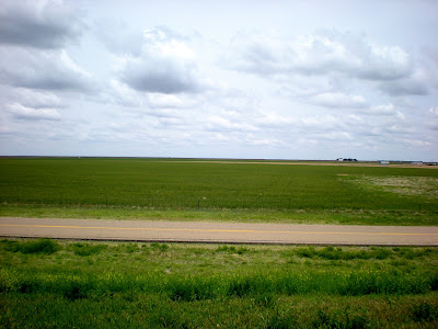
Whoever coined the phrase “I could see it coming a mile away” must have grown up on the plains. The other day I commented about how flat Arkansas was near the Mississippi River, but that was nothing compared to I-40 before and after Amarillo, Texas. I’ve only experienced real flatness at the beach, where you can look upon the ocean’s horizon and imagine Europe on the other side. But with the views of the Texas panhandle on I-40, I felt much different, sort of surrounded by emptiness, which is an odd sensation I don’t really know how to describe. I suppose it was sort of like listening to the sound of silence, put in another sense (if that even makes sense). Nothing restricted my gaze in any direction, and instead of feeling lost, I felt comforted. It was so flat that if you had a mohawk, beehive, or afro on your head I would have seen you from five miles away. Literally.

This flatness really helped me in Groom, Texas. I saw something odd in the distance that looked like another wind turbine. In the meantime, I passed a billboard that touted “The Largest Cross in the Western Hemisphere.” Interesting, I thought. I hoped I wouldn’t have to get off the interstate to see it, as it was threatening rain. Silly me, I should had just trusted the billboard. The suspected wind turbine, which I saw from almost eight miles away (I measured), turned out to be this giant cross. I should have trusted the billboard-makers. After all, if they were boasting about the size of their cross, they certainly wouldn’t lie about it (although it turns out their billboard is a bit outdated, as another church in Illinois saw the cross in Groom and decided to build their own eight feet higher). The cross is 190 feet tall. That’s a lot of cross.

The weather held up today for 400 miles. We started under overcast skies for the first 50 miles, transitioned to clear blue for 200 miles, and then came back to threatening skies once again for the final 150 miles to Tucumcari (pronounced Too-kum-kair-ee). The landscape gradually changed from green and rolling (but expansive) to flat and drab. New Mexico finally emerged as if out of nowhere, though, as the landscape shifted rather quickly to become full of brittlebrush and mesas.

Our hotel is on the old Route 66. More to come tomorrow on Tucumcari. We’ll have the day to rest and explore a little bit. I hear there is some kind of dinosaur museum down the road.

403.5 miles today. 1,520.7 total miles.

Wednesday, May 14, 2008

Shawnee and the Rain

Well, I guess you can see the Welcome to Oklahoma sign as well as I can. I managed to pull over within three feet of it. So that's two out of three states so far. We passed the 1,000-mile mark just after crossing into Oklahoma.

The word for the day is wet. We drove the final 15o miles in rain, and the last 5o of those were in a downpour. It's not something we want to do again, but we will if necessary. Our bodies got fairly wet. However, our waterproof baggage did the job perfectly and did not allow a single packed item to get wet (including my blogging-emailing-teaching MacBook Pro!).

We stopped for a break at the Oklahoma Welcome Center in Sallislaw. A very nice woman named Nancy provided much-needed information about the weather by going to Weather.com and checking the radar. She also showed us around the Center, which was a beautiful celebration of Native America history. I've posted some photos in the Shawnee album, so check them out. The Shawnee tribe is our destination's namesake, and I'm naturally partial to the Seminoles!

The most powerful image there was a mural reproduction of the original "Trail of Tears" painting done in 1942 by Robert Lindneux. The original makes frequent appearances in history books. According to information provided by Nancy, it tells the story of the forced march of the Cherokees from their homeland in the southeastern United States to the Indian Territory in the winter of 1838-1839. The painting depicts the Cherokee's arrival in their new country, which is now northeastern Oklahoma.

You'll also notice a smaller version of a statue of Sequoyah found at his home site in the area. Sequoyah is most famous for creating the Cherokee alphabet by establishing a character for various syllables, 86 in all. It took him 12 years. I also took a photo of Will Rogers, another famous Cherokee-American from Oklahoma. He was a humorist in the vein of Mark Twain, as well as an actor, cowboy, and philosopher.

After arriving in Shawnee soaked and cold, we had dinner next door at Cracker Barrel. I was hoping for some local flavor, but, hey, you can't beat the vegetable platter when it's raining and only ten paces from your hotel. To top off the evening, we took a dip in the indoor jacuzzi and had a cookie or two. Good ol' Hampton Inn!

Tomorrow we are supposed to go 400 miles, so let's hope for drier weather!

Finally, check out my wife's blog I've linked under my profile. She's quite the humorist herself!

327 miles today. 1,117.2 total miles.

Tuesday, May 13, 2008

The Music Higway

We traveled down the "Music Highway" between Nashville and Memphis today. Although we didn't stop to see any of the attractions (such as Loretta Lynn's 'Country Kitchen), we enjoyed this stretch of highway. The weather was once again hectic, though, to say the least. We left Nashville under a completely blue sky but were rained on within one hour. Later, as we approached Memphis, the sun came out again but didn't last.

I failed to get a photo of the Arkansas state line. Turns out the official state line between Tennessee and Arkansas is halfway across the Mississippi River. We crossed the bridge on I-40, and if it hadn't been so windy I would have just held up the camera as we passed underneath. So, no photos of the state line.

The highway from Nashville to Memphis and then into the Arkansas delta region unfolds in one long downhill trajectory. Highway 64 through Arkansas from beyond the state line to Searcy reveals nothing but horizon. I never imagined it was so flat. There were miles and miles of rice paddies (Arkansas grows more rice than any other state in the USA).

We included Searcy on our itinerary because some of my old friends from Florida State University graduate school live there. They took us out to dinner, but, of course I forgot my camera at the hotel. That's why no photos accompany this entry. My friends had just come from coaching their five-year old's t-ball game, so they weren't so upset about not having their picture appear here.

Tomorrow, we expect to be rained on all day. I'll make sure to take plenty of pictures to make up for none today. We plan to be on the road by 7:30 a.m.

304.3 miles today. 790.2 total miles.

Monday, May 12, 2008

The Road to Nashville

We left Spring Creek about 9:00 this morning under very ominous skies and about 48 degrees. Of course, we bundled up sufficiently. Highway 209 leaves Spring Creek to the northwest, which takes you through some extremely curvy roads and through the Pisgah National Forest before arriving at Hot Springs. Hot Springs used to be a famous resort town about 100 years ago. It had a huge luxury hotel that attracted famous people from all over, but the hotel burned and was not rebuilt. The Hot Springs are still there, however, and you can visit them. We highly recommend this trip on motorcycle or car.

I took my father's picture at the Tennessee state line. I am going to try to take a photo of every single state line sign we pass on this trip, but this will most likely be impossible. Tomorrow will certainly be a challenge, as we'll come into Arkansas when we cross the Mississippi River. I'm sure it will be to difficult to stop along the bridge to take that shot of the sign!

Today we took I-40 from Newport, Tennessee, all the way to Nashville. The weather got much better, and we pulled into our hotel under crystal blue sky. We gained an hour of time, and Dad is already looking forward to using it tonight when he goes to sleep.

285.7 miles today. 485.9 total miles.

Departure


We left High Point around 10:30 on Sunday morning, May 11, 2008. It was a bittersweet moment. I knew that I was lucky to have this opportunity to travel across America, but I wouldn’t be able to experience it with the people disappearing in my rear view mirror. I love my family very much, and I’m already counting down the days until I see them again.

The weather was difficulty today. We got rained on almost immediately, which served as a good test for our waterproof gear (the gear passed, mostly). Luckily, we managed to miss most of the severe weather or tornado warnings that affected some areas not far away. We arrived in Spring Creek around 2:45 in the afternoon. We spent our first night on the road at the most familiar of places, “The Farm.”

The Flats of Spring Creek

In the Davis family, The Farm refers to several hundred acres of the original Davis homestead located off Highway 209 in Madison County, North Carolina. The highway (a narrow two-lane blacktop) crosses Betsy’s Mountain and emerges around a final sharp right turn to reveal over two miles of valley straightaway. This area is known as The Flats of Spring Creek, which is the home place for both my father and my mother. Both attended Spring Creek School from kindergarten through 12th grade and were part of a graduating class of 12 students. The school was made of stone and was closed in the 1980s, but it is currently being restored to become a Community Center. It already houses a restaurant (named Grits), a sheriff’s substation, and in the future will contain a library.

The Davis and Ferguson families (my father’s and mother’s sides, respectively) have been on Spring Creek since at least the mid-1850s, according to the earliest land deeds that have been located. Of course, both families were farmers, tobacco especially. I did not enjoy coming to Spring Creek as a child. It was so isolated that we only received one radio and one television station. I spent a lot time outside hitting rocks with tobacco sticks.

I have included photos of both original homsteads for the Davis and Ferguson families. The white house (Davis) was built around 1855, while the other house (the Ferguson house, with the silo) was built around 1900. My mother’s brother commissioned a mural for the side of the silo. You will see a picture of the silo in a recently published book called “The Literary Trails of Western North Carolina.”

My father completed a total restoration of the original Davis home in the late 1990s. He and my stepmother spend many weekends there. Also, my uncle (father’s brother) has retired and moved back to Spring Creek (although he won’t stop working). The newer red barns in the photos are his, and he continues to operate a working farm, which he has named Davis Cove Farms.

Spring Creek is a special place, and I’m thankful now that it is part of my life.

202 miles today. 202 total miles.